Google Maps will display latitude and longitude values, and there are several methods to obtain these numbers. These techniques will provide the latitude and longitude coordinates for any location on the map. This article has been revised for the latest version of Google Maps.
Previously, users had to paste custom JavaScript into the URL box of Google Maps to be able to display the latitude and longitude of an address. With the latest version of Google Maps, this is no longer required.
Finding Latitude and Longitude Directly
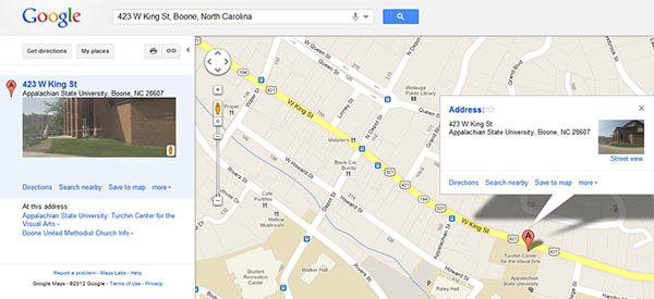
1To begin with, search for your desired location as you normally would.
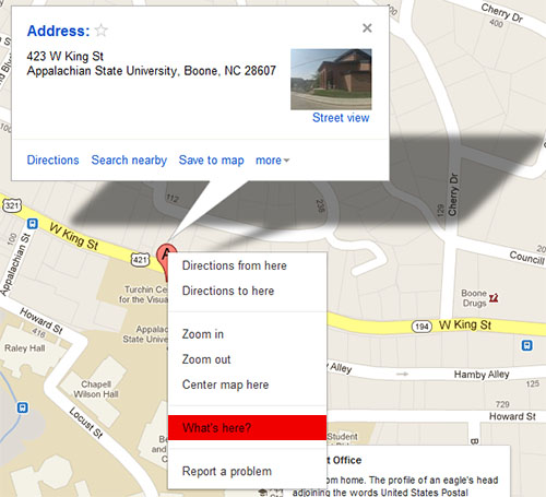
2Next, right click the red “A” pin displayed on the map. Select What’s here?
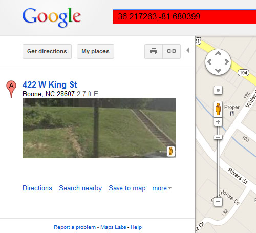
3Once you’ve clicked What’s here?, Google Maps will automatically display the (latitude, longitude) pair in the Address search bar at the top of the Google Maps page.
Previous Javascript Method
Looking up an address in Google Maps will center the map on that address if it was found. Because this trick provides the latitude and longitude of the center of the map, moving the map around manually after that will change the center position and this technique will not work accurately.
When the location you want is in the center of the map, copy and paste this code into the location bar of your browser and press enter:
javascript:void(prompt('',gApplication.getMap().getCenter()));
A little dialog box will pop up displaying the coordinates which can be copied and pasted for use elsewhere. This code can be bookmarked and then used in the future by selecting the bookmark.
If these methods don’t help you with all, we also have other methods for finding latitude and longitude.


